WebUnion Media Limited

Interactive Map Highlight

Represent Multiple Database Stats on Heat Map/ Choropleth Map

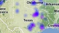
Heat Maps or Choropleth Maps are a thematic maps for geographical representation of statistics by dots or by areas. Heat Map uses a color progression or gradients to depict data per area. Data source usually come from databases or even Excel files.


Cloud Based Mapping Solution

Access from anywhere to view or edit maps online.
Able to locate addresses or build street level maps.
Import or export data efficiently.

Try Online Learn More


Mapping Software

Software with ready made vector maps of almost all countries.
Generate geographical heat map for data visualization.
Color or label a map for presentation on the web.

Download Learn More


Interactive Image Creator

Turn your static image into an interactive element for web.
Highlight areas or draw routes on your plan.
Software produce cross device output, mobile ready.

Download Learn More


Website Building Solution

Create website and customize the design using our software.
Expertise in database and management system setup.
Provide custom made web projects upon demand.

Download Learn More

Back To Top